Day 20 Cromwell to Queenstown
- Colin Grierson
- Dec 20, 2024
- 5 min read


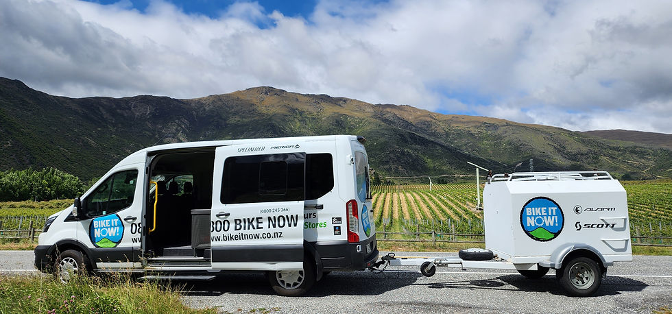
We've let ourselves be talked into taking a shuttle to Gibbston valley so we do not have to ride the narrow and busy 22 km Kawarau gorge road. Our shuttle leaves at 10:30 so we have a bit of time, lie in a bit, pack, buy a tube of toothpaste and take a selfie by Cromwell's fruit.

A track is being built through the Kawarau gorge. As we are driven through we can see parts of it and welding being done on a suspended section to get around a bluff. A lot has been built, but plenty remains to be built. Probably next year we can return and ride this section.
Our driver is very friendly and talkative, he seems a little reluctant to 'abandon' us here.
This track is in much better condition than when we rode on it 2 years ago. We presume they are preparing for when the new track is ready and this is part of the link to all the Otago tracks - it has to be up to standard.

Gibbston valley is famous for wineries, but neither of us are into wine so we are not tempted to spend time along the way tasting.

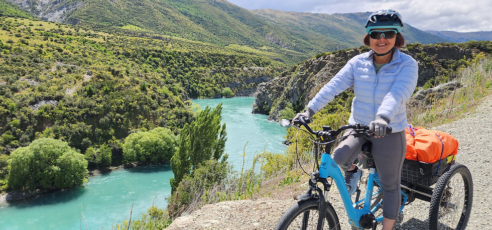
At first the track is beside the road but after a couple of kilometers it veers off, drops down and we are beside the Kawarau river. Turquoise blue, plenty of water and flowing fast. So good. Every corner gives another view and I keep stopping to take photos even though I know that later they will all look much the same.
An ambulance at the bungee jump centre? Has something bad happened? I expect to see proceedings stopped, but no, someone is about to jump - and does! I even get a photo of him falling! Maybe the ambulance is here for another reason, or is just passing through.


We cross the river on the bridge they use for the bungy jumping. The launch platform is below us, so no problem. There is a great view of the river and gorge from here.

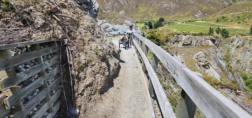
A bit past the bridge we run into a problem. There has been a slip and the track has been cleared, but only enough to just allow a bicycle to pass. The trike won't fit. Several riders have passed us this morning - this is the busiest track we have been on during our entire trip - but no one is in sight now. I think a bit then use one of our bungee cords to hold the trike front wheel pointing forward, lift the back above the narrow section and wheel the trike through. Neatly done even if I say so myself :-)

Sau Keng photographed me from on the other side of this large bend around a gully created by a surprisingly small stream. Can you find me?

The Arrow river joins the Kawarau just past the bend. It's quite spectacular: two deep gorges split by a narrow wedge of rock. Unfortunately I can not find a place to take a photo that properly shows it. The Arrow river gorge, through hard rock, is also impressive given how small the river is.


Hollyhocks? (no foxgloves) Very pretty whatever they are. We have not seen many of these until today.
As we get closer to Arrowtown the severe rocky gorge opens out, softens, and transforms to a soft green valley. Its a remarkable transformation.

Arrowtown is cute and looks historical and is FULL of people. Such a contrast to the towns where we have been staying, particularly Clyde. We have a light lunch here, it really is a problem choosing which of the many eating places we should use.

Leaving Arrowtown the feeling of being in a park persists. Now we really are in a park as the track takes us through Millbrook Resort & Country club.


Somewhere I have gone astray? We are on a nice new track heading to Arthurs point. I'd intended to ride on the track past lake Hayes to the old Shotover bridge. I don't know if this track continues to Queenstown or if we have to ride the last portion on the road. I know Arthurs point is high and the road down steep. I don't know how much of a climb is required from this side. We want to get 'home' in time to shower and meet a friend of mine. I bail out and take Dalefield road, this will take us back to my intended route.
Dalefield road takes us out of the valley, which means a climb, more than I expected... But zooming down is great :-) ... This road feels familiar... Yes, we went astray here last time, missing our turnoff and riding along it for a kilometre or so before backtracking.

We are back on track but Queenstown is still 13 kilometres away, it's a lot further from Arrowtown than I remembered. My change of plan did not help either. We won't make it in time to meet my friend. :-( Sorry Peter.

Our track follows the Shotover until it meets the Kawarau river. The delta is so wide and overgrown we don't see the point of confluence. However when we do see the Kawarau, before the Shotover joins it, what a different colour!

As we near the Kawarau falls bridge the track changes, it's not nearly as wide or well formed, and just before the bridge it has a short steep rise - so steep we both lose traction and have to stop. It's way out of character compared to the rest of the twin rivers track. I push the trike up the last few metres.

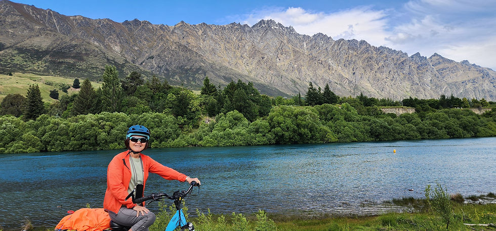
Finally we are on the shore of lake Wakatipu. We gave up on meeting my friend a while ago and are relaxed again.

We follow the track all the way to downtown Queenstown by the waterfront. So many people! It's a happy busy feel, like Arrowtown, and so different to our experience before today.


Now, where's our motel? My map is showing it nearby, just behind the downtown area. Sau Keng's shows it 2 km back, where we came from? I re enter my search and now the maps agree. I don't know what place mine found first time, I can't make it find that location again.
We are riding back along the waterfront track and turn onto a steep path going up to the main road. It's very steep, too much for me to cycle! Sau Keng does better and keeps going. I walk my bike up and find her stalled - stairs in front of her. This is the path Google maps recommended for cycling - it's not a perfect service yet! Sau Keng wants to go back down, return to the road and come back on that. But we are almost there - up the stairs and across the road is our motel. So close... I try to get the trike up the stairs, a local resident helps and finally we are home. It's taken much longer than expected.


We settle in, shower, then head back to town - this time using the road. Now the problem is to find somewhere to go for dinner - there is far too much choice! My pick tonight, a Japanese restaurant. It reminds us of Tokyo dinner - Small. Chef in a closed off rectangular area. We want soba, which is on the lunch menu - the chef nods, and we have soba :-)

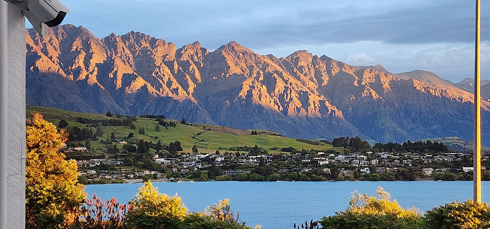
Back home, by road of course, we admire the view our motel. It gets better and better as sunset changes the lighting on the lake and mountains.


Statistics
Distance 62 km
Climbed 648 m
Time 5:32


Comments